
The Metrological Office forecasted sunshine today which will be interrupted with light to moderate showers in a few areas across T&T.
Saharan dust is also present in the atmosphere in mainly moderate sometimes high concentrations and will remain like this for most of the week.
There is a medium chance for isolated thunderstorm activity during the late morning into the afternoon.
In the event of a heavy shower or thunderstorm always be on the lookout for street or flash flooding and gusty winds in the vicinity.
Although the axis of the next tropical wave in the central North Atlantic is expected to reach the Lesser Antilles around Thursday into Friday, because of its orientation and wavelength, it is projecting some convergence ahead of it at the latitude of Trinidad and Tobago. Over the next few days, this convergence, along with morning surface heating and local dynamics will assist the development of showers or thunderstorm activity in a few areas. With the arrival of the axis of this wave, most of the associated convective activity (showers and thunderstorms) is expected to occur north of Trinidad and Tobago, mainly in the Northern Windwards and the Leewards.
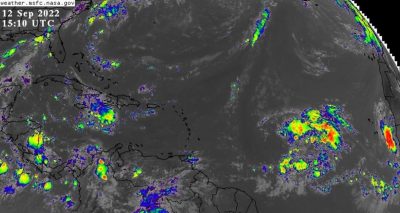
There are two flagged areas of disturbance in the tropical North Atlantic east of the Lesser Antilles today. One area in the central North Atlantic is associated with the next tropical wave approaching the Lesser Antilles and the other is just off the western coast of Africa. Both areas are given a 20% chance for cyclonic development over the next five days. Both areas are projected to track to the WNW and they pose no direct threat to Trinidad and Tobago, at this time.
Source: MET OFFICE
COMMENTS