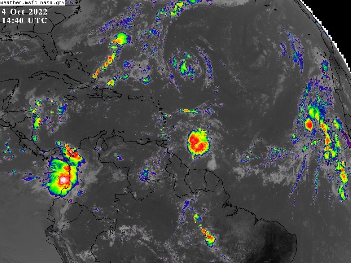
The Trinidad and Tobago Meteorological Service said it will continue to monitor an active tropical wave to the east of the Windward Islands.
As at 8 a.m. today Tuesday 4th October, the leading edge of this tropical wave was located near 56W or about 450 km east of Tobago and moving to the west near 28 km/h. The National Hurricane Center has given this tropical wave a low (20%) chance of developing into a Tropical Cyclone in 48 hours and a medium (40%) chance of development in five (5) days.
Regardless of development, moist and unstable conditions would exist over the islands. Trinidad and Tobago would experience cloudy skies with periods of showers and a medium to high chance of thunderstorm activity.
The onset of these conditions is expected from the early hours of tomorrow morning, Wednesday 5th October 2022, and activity may linger until Friday 7th October 2022.
At present, there are no alerts, watches or warnings in effect for Trinidad and Tobago.
The TTMS said an update will be issued on Wednesday morning (5th October 2022) or earlier if the situation warrants.
Source: Met Office


COMMENTS